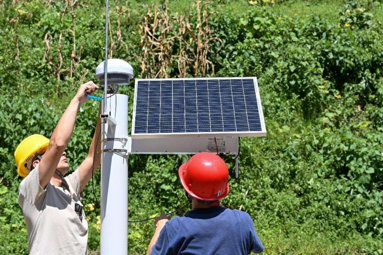
By Kou Jiangze, Yao Xueqing, Early in the morning, Shen Wei arrived at the Gehu Lake, upstream of the Taihu Lake in east China’s Jiangsu province, with a toolbox, to conduct routine water quality and aquatic organism monitoring. Meanwhile, Shen’s colleagues were sampling water from the lake with a water collector for the monitoring of planktonic algae.
After the sampling was completed, Shen, deputy chief of the ecological department of the Changzhou Environmental Monitoring Center, which initiated a comprehensive ecological monitoring network for water bodies on the plains of Changzhou, returned to the lab with his colleagues and started analyzing samples.
“We discovered Novaculina chinensis, a national second-class protected aquatic wild animal, and we have found it at multiple locations many times,” said Shen. According to him, this indicated that the ecological condition of Gehu Lake was improving.
The monitoring of planktonic algae also had some positive findings – diatoms, the dominant species in the winter lake, were at normal levels and varieties.
Ecological monitoring is essential for obtaining an objective and accurate understanding of the ecological conditions in a given area, implementing scientific ecological protection and restoration measures, and evaluating their outcomes.
Recently, China’s Ministry of Ecology and Environment, in collaboration with the Chinese Academy of Sciences, issued a work plan on national ecological quality supervision and monitoring for the 2023-2025 period.
According to the plan, China will set up a national ecological monitoring network and designate 55 sites as the first batch of national stations for monitoring ecological quality, including a station in Xishuangbanna, southwest China’s Yunnan province, and the comprehensive ecological monitoring network for water bodies on the plains of Changzhou.
The first batch of national stations for monitoring ecological quality cover major ecosystem types such as forests, wetlands, grasslands, deserts, oceans, cities, and farmlands. They span 44 key ecological conservation and regulatory areas in China, as well as other important ecological regions and urban clusters with frequent human activities.
Compared to environmental monitoring, ecological monitoring features richer content, more complex indicators, and more diverse methods.
“The national ecological monitoring network takes species diversity and habitats as its monitoring objects, with the goals of highlighting supervision, finding problems, and accumulating data. It focuses on the composition, structure, and functions of biological communities and species, enabling comprehensive monitoring of all types of ecosystems within a 100 km radius of each monitoring station,” said Dong Mingli, an official with China’s Ministry of Ecology and Environment.
In the Xishuangbanna National Nature Reserve in Yunnan, Yuan Shengdong and other scientific researchers from the Xishuangbanna tropical rainforest ecosystem station walked into the depths of the dense forest to carry out routine field monitoring at designated plots, including measuring, marking, sampling, and recording.
For most of the year, the staff at this station are out in the field. “We collect millions of monitoring data every year, including various types such as biology, meteorology, hydrology, and soil,” said Yuan.
He further explained that studying the dynamics of tropical rainforests requires long-term data accumulation, as short-term observations do not yield immediate results. Therefore, researchers need to diligently work day by day to gather the necessary data for studying the changes in the rainforest ecosystem.
Dong said that the national ecological monitoring network takes monitoring stations as regional centers, monitoring plots as the primary objects, and ground mobile patrols as a supplement. Working in sync with remote sensing, it integrates satellite resources, manned and unmanned aerial vehicles, ground fixed and mobile patrol monitoring, and other observation methods to establish an integrated sky-ground ecological monitoring technology system, Dong explained.
It is learned that satellite remote sensing monitoring boasts a wide coverage. It can monitor land surface changes promptly and discover ecological damages, serving as the primary means for ecological supervision.
Unmanned aerial vehicles are flexible and responsive. They can carry visible infrared sensors, hyperspectral sensors, LiDAR, and other payloads to conduct on-site investigations and technical calibrations of damage clues and changes of ecological types in key areas. This provides data support for the verification of ecological damages and validation of remote sensing parameters.
Ground monitoring mainly utilizes video surveillance, patrols, plot monitoring, and other means to conduct real-time monitoring of key sensitive areas and discover problems like human interference.
Ecological monitoring not only aims to present the current status and changes in regional ecological quality but also focuses on enhancing the ability to proactively detect ecological issues.
“For example, cyanobacterial bloom is a prominent issue in the treatment of the Taihu Lake. The monitoring station utilizes historical data to study the competitive growth mechanisms of aquatic plants and cyanobacteria, providing technical support for scientific and precise artificial restoration of the ecological environment,” said Pan Chen, director of the Changzhou Environmental Monitoring Center.


