By Feng Hua, Zhang Wei, People’s Daily
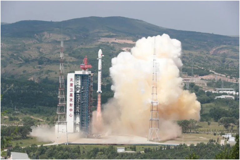
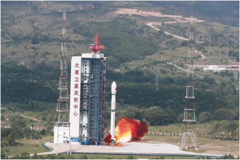
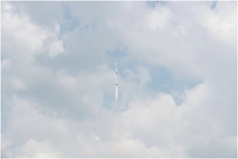
China recently successfully launched a terrestrial ecosystem carbon monitoring satellite from the Taiyuan Satellite Launch Center in north China’s Shanxi Province.
Named “Goumang,”the satellite is expected to provideremote sensing services andimprove the efficiency and accuracy of carbon sink measurement, providing important support for the country’s efforts to peak carbondioxide emissions before 2030 and achieve carbon neutrality before 2060.
As a scientific research satelliteunder the framework ofChina’s medium and long-term development plan of nationalcivilian space infrastructure, Goumangwill operate in a sun-synchronous orbit at an altitude of 506 kilometers, inclined 97.4 degrees, according toCao Haiyi, chief designer of Goumang.
The satellite is able todetect and measure such factors as vegetation biomass, atmospheric aerosol and chlorophyll fluorescencethroughcomprehensive remote sensing means, including laser, multi-angle, multi-spectral, hyperspectral, and polarization.
The satellite can provide a wide variety of services, such asmonitoring carbon in the terrestrialecosystem, surveying and monitoring terrestrial ecology and resources, monitoring and evaluating major environmental protection projects, monitoring the atmospheric environment, and obtaining data about the effect of aerosols on climate change.
Moreover, the satellite will also meet the needs for the determination of vertical control points, disaster monitoring and evaluation, and agricultural forecasting. It will significantlyboost quantitative land remote sensing in China.
The satellite can obtain information aboutglobal forest carbon sinks through both active and passive remote sensing. This will help enhance the country’s capability to monitor and measure carbon sinks in various ecosystems, including forests, grasslands, wetlands and desertified land.
Equippedwithpayloads including laser radar, multi-angle and multi-spectral camera, hyperspectral detector and polarization imager,Goumangcan monitor key data on carbon sink capacity offorests, including plant height, vegetation coverage, chlorophyll fluorescence, and PM2.5 concentrations, helping improve the efficiency and accuracy of carbon sink measurement.
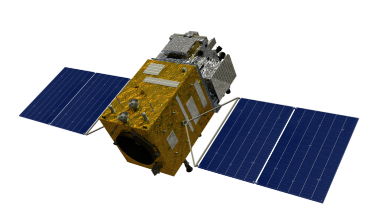
The multi-beam laser radar enables the satellite to measure the height ofa tree by calculating the difference between the time when the laser beams scan the crown of the tree and the time when the laser beams scan the ground.
Through statistical analysis and application tests, the research and development (R&D) teamhas managed to usefive laser devices on the radar to emit laser beams 200 times in one second, eventually shortening the distance between two objects to be monitored from several thousand meters to several hundred meters andsignificantly improving the accuracy of plant height measurement.
The satellite has five multi-spectral cameras, which can help monitor the Earth from five angles. This enables the satellite to accurately measurevegetation coverage and the density of forests.Thefive multi-spectral camerascan help the satellitecreatea three-dimensional map with high accuracy of the distribution of vegetationin the area monitored by the satellite.
The satellite’s ability to accurately map the distribution of chlorophyll fluorescenceoffers important support forthe efficient andprecise measurement of carbon sinks.To improve the accuracy of detecting the spectrum of chlorophyll fluorescence, which emits only a very small amount of energy, a hyperspectral detectorhas been installed in the satellite and the theory ofgrating spectrometer has been applied, which increased the spectralresolutionby tenfold, enabling the device todetect even the most subtle change in daylight intensity.
In order to remove the atmospheric effects, a polarization imagerhas been installed onthe satellite, which is able to detectPM2.5 concentrations from 35 angles and obtain information abouthorizontal PM2.5 concentrations.
In addition, the satellite is also equipped with alaser radar, which can help monitor longitudinal PM2.5 concentrations.These two payloadsenable the satellite to provide information about PM2.5 concentrations from three dimensions, guaranteeing a higher level of accuracy for atmospheric correction.
The launch of Goumangmarked the 430th mission of the Long March rocket family. Also launched on the same rocket were two small satellites, namely the Jiaotong 4 and the Minhang Youth.
The Jiaotong 4 will be used to collect information about ship movements and flight statuses around the globe, as well as information aboutthe global Internet of Things (IoT). The Minhang Youth, which is designated as a platform for young students to partake in space science research and engineering practice activities, including satellite design, satellite R&D,satellite payloads, and satellite launch, will carry outapplied scientific researchonspace-Earth integrated carbon source monitoring.